

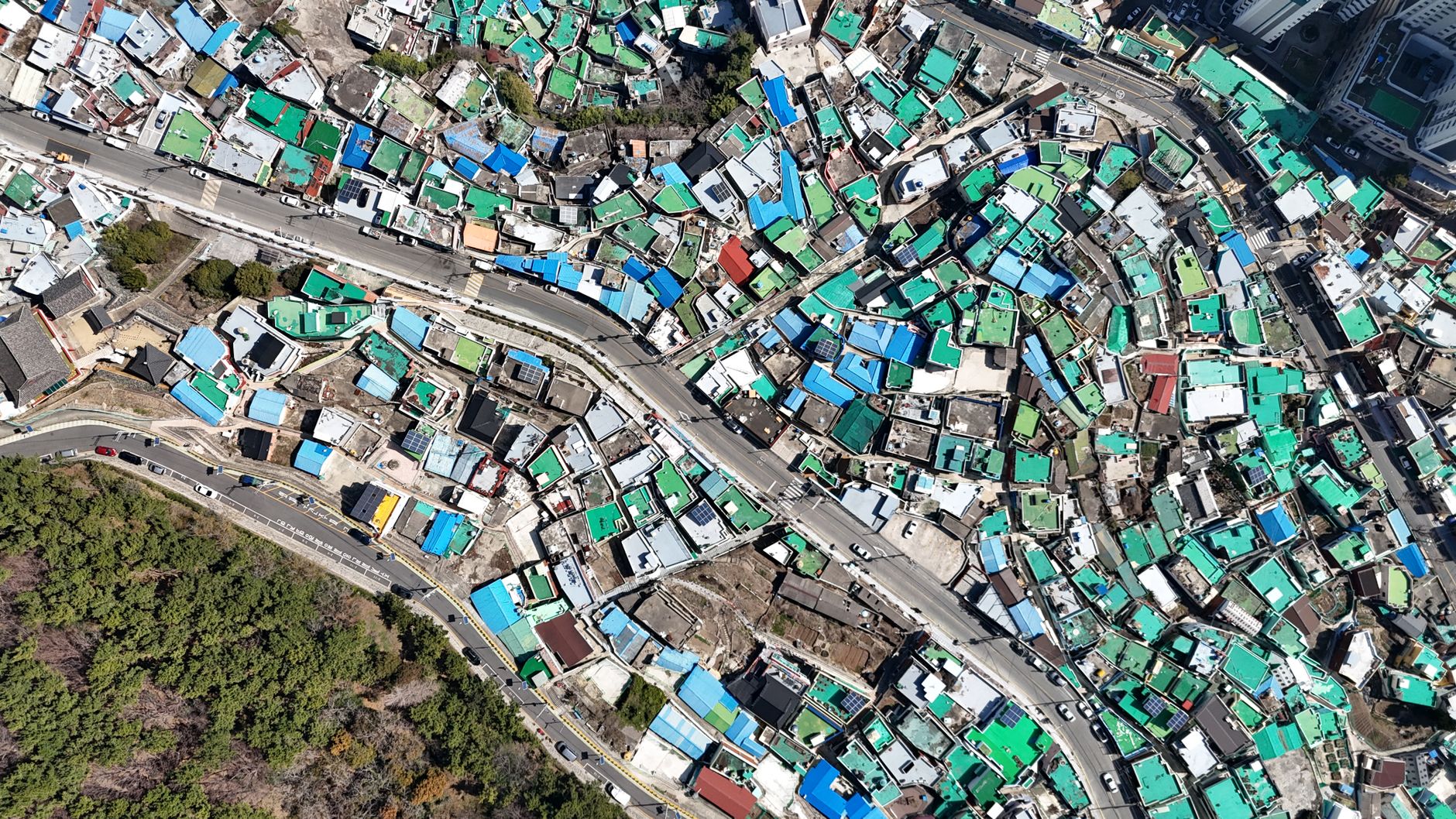
Korean microsatellite images were captured within a day of launch, marking a significant achievement in space technology. This rapid image acquisition demonstrates the capabilities of the new satellite constellation.
Overview of the Korean microsatellite launch
The recent launch of the Republic of Korea’s microsatellite constellation marks a significant milestone in the nation’s space exploration endeavors. This innovative project aims to enhance the country’s capabilities in earth observation and data collection. Within just one day of its launch, the microsatellites successfully captured their first stunning images, showcasing the effectiveness of this advanced technology.
The launch involved a series of microsatellites designed to operate in tandem, allowing for real-time monitoring of various environmental conditions. These Korean microsatellite images provide crucial insights into agriculture, urban development, and disaster management. The ability to quickly gather data from space will enable researchers and policymakers to make more informed decisions.
- Launch Details: The microsatellites were deployed aboard a dedicated rocket, ensuring precise placement in orbit.
- Technical Specifications: Each microsatellite is equipped with high-resolution cameras and sensors capable of capturing detailed images.
- Future Prospects: This initiative is expected to expand, with plans for additional satellites to enhance coverage and data accuracy.
The swift acquisition of high-quality images underscores the potential for the Korean microsatellite program to contribute significantly to both national and global scientific efforts.
Significance of rapid image capture
The recent launch of the Korean microsatellite constellation has highlighted the significance of rapid image capture in the realm of satellite technology. Within just a day of deployment, the microsatellites successfully transmitted their first stunning images, showcasing the capabilities of advanced imaging systems in space.
This swift ability to capture and relay images is crucial for a variety of applications, from environmental monitoring to urban planning. The Korean microsatellite images serve as a prime example of how timely data can enhance decision-making processes in numerous fields.
Among the key benefits of rapid image capture are:
- Disaster response: Quick access to high-resolution images allows for timely assessments following natural disasters, aiding in rescue and recovery efforts.
- Agricultural monitoring: Farmers can receive real-time insights into crop health, enabling them to make informed decisions and optimize yields.
- Urban development: City planners can utilize immediate data to better understand land use changes and infrastructure needs.
The implications of this technology extend beyond immediate observations; they pave the way for more dynamic and responsive applications of satellite imagery. As the demand for timely data grows, the Korean microsatellite images represent a significant advancement in capturing the world from above.
Technology behind the microsatellite constellation
The recent launch of the Korean microsatellite constellation has brought forth a new era in satellite imaging technology. Utilizing advanced engineering and cutting-edge components, these microsatellites are designed to capture high-resolution images efficiently and effectively. The constellation’s architecture incorporates multiple satellites working in tandem, allowing for rapid coverage of vast areas. This innovative design enables the quick capture of stunning first photos shortly after deployment.
One of the key features of this technology is the use of miniaturized sensors that retain the capability to produce high-quality images comparable to those from larger satellites. These sensors are paired with state-of-the-art onboard processing units that optimize data transmission and image quality. The result is a system that can deliver timely visual data, which is crucial for various applications, including disaster monitoring, urban planning, and agricultural assessments.
Moreover, the microsatellites benefit from advanced propulsion systems, allowing them to adjust their orbits seamlessly and capture images from multiple angles. This flexibility ensures that the Korean microsatellite images are not only rapid but also comprehensive, providing detailed insights and improving situational awareness in a range of scenarios.
In conclusion, the technology behind the Korean microsatellite constellation represents a significant leap forward in satellite imaging, promising to enhance our understanding of the planet.
First images: What do they show?
The recent launch of the Korean microsatellite constellation has resulted in the rapid capture of stunning first images, showcasing the advanced capabilities of these satellites. Within just a day of their deployment, the microsatellites have provided high-resolution imagery that highlights various geographical features and urban landscapes across the Korean Peninsula.
These initial images demonstrate the satellites’ ability to capture details that are crucial for multiple applications, including:
- Agricultural monitoring: The images provide insights into crop health and growth patterns, allowing for improved agricultural practices.
- Urban planning: City planners can analyze the expansion of urban areas, helping to shape future development strategies.
- Environmental assessment: The microsatellite images can be used to monitor deforestation, water bodies, and other ecological changes.
One of the most striking features of these Korean microsatellite images is their clarity and detail, which surpasses many existing satellite technologies. As the constellation continues to operate, the data collected will not only enhance scientific research but also support disaster management and response efforts across the region.
Overall, the successful deployment and quick capture of images by the Korean microsatellites mark a significant step forward in satellite technology and its applications in everyday life.
Future implications for space exploration
The successful deployment of the Korean microsatellite constellation marks a significant advancement not only in satellite technology but also in the broader field of space exploration. These microsatellites are designed to capture high-resolution images swiftly, enabling researchers and organizations to gather vital data in real-time. This capability could revolutionize various sectors, including agriculture, disaster management, and environmental monitoring.
As the Korean microsatellite images demonstrate, the ability to acquire images within a day of launch opens new avenues for rapid response to natural disasters. For instance, in the event of an earthquake or flood, these satellites could provide immediate visual assessments, helping authorities make informed decisions quickly. Moreover, the detailed imagery can assist scientists in tracking climate change and its impacts on different regions.
Furthermore, the technology behind these microsatellites could pave the way for future missions beyond Earth. As cost-effective and efficient solutions, they could support exploratory missions to other planets or moons, potentially gathering data about environmental conditions and surface characteristics. This innovation in satellite technology signifies a shift towards more agile and responsive space exploration, positioning Korea as a key player in the global space community.
Comparing microsatellites to traditional satellites
The recent launch of the Korean microsatellite constellation marks a significant advancement in satellite technology, particularly when comparing these microsatellites to traditional satellites. While traditional satellites are often large and equipped with complex systems, microsatellites are smaller, lighter, and more efficient.
One of the most notable differences is the speed of deployment and image capture. Traditional satellites often require extensive planning, development, and testing phases that can take years before they become operational. In contrast, the Korean microsatellite images were captured within a day of launch, showcasing their ability to provide timely data.
Additionally, microsatellites tend to be more cost-effective. Their smaller size allows for reduced launch costs and simplified manufacturing processes. This financial efficiency enables more frequent launches, leading to an increase in the number of satellites that can be deployed over time.
Moreover, the flexibility of microsatellites allows for a wider variety of missions. They can be quickly adapted for specific tasks, such as environmental monitoring or disaster response, unlike traditional satellites that often have fixed purposes.
In summary, the Korean microsatellite images reveal a new era of satellite capabilities, emphasizing rapid deployment and cost-effectiveness compared to their traditional counterparts. This shift could transform how we approach data collection and analysis from space.
The role of the Korea Space Agency
The Korea Space Agency has played a pivotal role in the successful deployment and operation of the new microsatellite constellation. With a focus on enhancing the capabilities of Earth observation, the agency has invested significantly in advanced imaging technology and satellite design. This initiative aims to provide quick access to high-resolution images, crucial for various applications such as agriculture, urban planning, and disaster management.
Upon launch, the Korean microsatellite images were captured almost immediately, showcasing the effectiveness of the technology developed by the agency. The rapid turnaround from launch to image acquisition demonstrates the agency’s commitment to leveraging space technology for national and global benefits.
Moreover, the Korea Space Agency has collaborated with international partners to enhance the capabilities of its microsatellite program. This cooperation facilitates knowledge exchange and helps to refine the technology used in capturing high-quality images from space.
The agency’s strategic vision includes not only the immediate benefits of rapid image capture but also the long-term potential of microsatellites in advancing space exploration. By continuously improving satellite technology, the Korea Space Agency is positioned to lead in the development of next-generation imaging systems that could transform how we observe and understand our planet.
As a result, the future of Korean microsatellite images remains bright, with promising developments on the horizon.
Public reaction to the images
The release of the first images captured by the Korean microsatellite constellation has sparked an enthusiastic public reaction. Social media platforms have been flooded with comments and shares as people marvel at the clarity and detail of the photos. Many users expressed their excitement about the rapid advancements in satellite technology, particularly emphasizing the capabilities of Korean microsatellite images.
In online forums, discussions have ranged from the potential applications of these images in environmental monitoring to their impact on national security. Some users noted how quickly the microsatellites were able to provide high-resolution imagery, which is a significant improvement over traditional satellite systems. This rapid turnaround time has been particularly praised, as it allows for timely responses to natural disasters and other urgent situations.
Moreover, the diverse range of images, including urban landscapes and agricultural fields, has captivated enthusiasts and professionals alike. Users have highlighted the importance of these images in research and development, suggesting they could play a crucial role in fields such as urban planning and climate science.
Overall, the initial public reaction reflects a growing interest in space technology and its implications for everyday life, showcasing how the Korean microsatellite images are not just a scientific achievement, but also a source of inspiration for many.
Korean microsatellite images have revolutionized the way we capture and analyze our planet’s landscapes. These stunning visuals provide unprecedented insights into environmental changes and urban development through Korean microsatellite images.
Photo by Evgeniy Mironov on Pexels
References
You might also like
- Is Wild n Chill game the Best New Adventure for Consoles?
- Dayz Update 1.86: The Best Patch Notes You Need to Know
- YouTube AI search feature: Best Simple Tool for Mobile